The Boiler Surf Report & Forecast
Surf Report and Surf Forecast
Nearby Spots


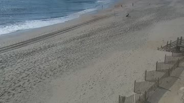


Current Surf Conditions
Condition Rating
Surf Height
0-1FT
Shin to knee
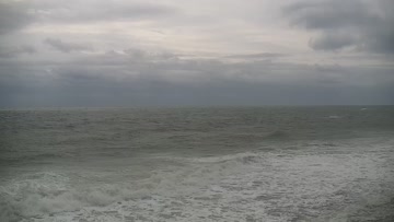
Swell
Wind
19KTSSSW
24kts gusts, Offshore

Tide
Temperature
83°F

Rashguard

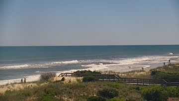
Hatteras Island Forecast
Tim Kent •Today
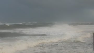
Minor sideshore southerly windswell at lunch. Surf rebuilds over the PM, biggest late in the day.
Midday: Mostly knee high surf with a few bigger sets for Avon-Buxton areas that can handle the higher tide at lunch. Conditions are side textured with building SW/SSW winds. Not much to it, but not flat.
Afternoon Outlook: We'll get stronger SSW winds to build over the afternoon and that sets up another round of developing windswell, mainly in the southern part of the region, but with poor conditions.
The Boiler Surf Forecast
LOTUS Model - our advanced surf forecasting system designed specifically for surfers...
The Boiler Surf Guide
Cape Hatteras, in the collective sense, is especially vulnerable to the combined effects of intense winds, abnormally high tides and heavy flooding due to both tropical and non-tropical systems. The highway through the Pea Island National Wildlife Refuge has been redesigned and pushed inland toward the Sound as storm activity continues to threaten this thin, 13-mile strip of sand. Before entering Pea Island, though, you pass over the new Marc Basnight Bridge which spans Oregon Inlet and connects... Read more
Wind data provided by NOAA and its data providers. Liability of any kind arising from use of the data is disclaimed by the providers, including without limitation accuracy, reliability and fitness for a particular purpose.